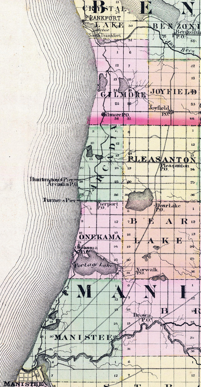
The Arcadia Area Shoreline in 1873
Next | Previous | Return to Start
|
|

This is part of a map from Atlas of the State of Michigan by Alexander Winchell published in 1873. This map shows the Lake Michigan shoreline between southern Benzie County and northern Manistee County.
In 1873, the only piers identified in this entire area are the Huntington Pier south of Arcadia and Turner’s Pier in Pierport.
Construction on Arcadia’s pier would begin in 1880. Arcadia’s safe harbor opened in 1893.
|
|

|
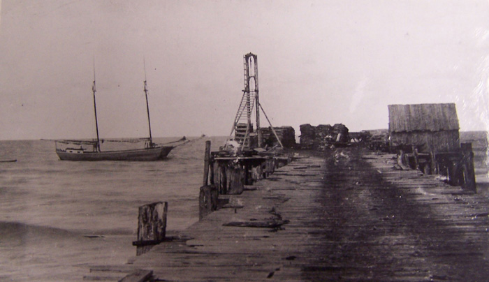
Bridge Pier at Pierport
Note the small railroad engine pulling cars. This was the western end of the Bear Lake and Eastern Railroad. At one point, Pierport had two bridge piers extending into Lake Michigan. The first one was built in 1866 by the Turnersport Pier Co. The second one, probably the one shown above, was built in 1879 by the Bear Lake Pier Co.
|
|
|
Bridge Pier Probably in Arcadia after 1880
Unlike Pierport, Arcadia’s railroad did not extend onto its pier, but as the two tracks in this photo indicate, a wagon or carriage of some kind was used to haul goods to and from the end of the pier
|
|
|
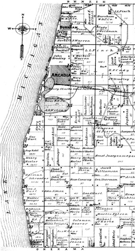
Burnham, north of Arcadia This is part of a plat map of Manistee County published in 1903 showing the Lake Michigan shoreline for Arcadia Township. Note the town of Burnham to the north. Founded in 1882, Burnham had a bridge pier used primarily to haul lumber from the Burnham Wood & Pier Co. sawmill.
The Burnham pier is not shown in the 1903 map. The Burnham Wood & Pier Co. closed around 1895. It is likely that the pier was abandoned, which led to its rapid deterioration and destruction.
The map shows Arcadia’s safe harbor was open. By this time its bridge pier had disappeared too.
|
Next | Previous | Return to Start