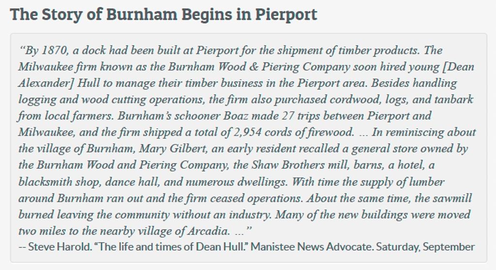
Under Re-Construction

1901 Blaine Township Map
This is the southwest corner of
Benzie County just north of
Arcadia Township in Manistee
County. The blue pin added to
the map marks Watervale's
location at the south end of
Herring Lake about 4 miles north
of Arcadia.


1901 Map of Watervale
Watervale is at the south end of Herring Lake. Note the Saw Mill at the southwest corner of the lake and the pier at the west end of the HIGHWAY. Also note the School House at the east end of the
HIGHWAY.


Remnants of the Pier in Lake
Michigan
Wood products produced at the
sawmill was shipped from what
was known as Hale's Pier in Lake
Michigan. When help was
needed to load a ship, the mill's
whistle called local farmers to
work.
-- Benzie Area Historical
Museum


The Hotel in May of 2014
Originally this was the boarding house for single loggers who worked for Leo Hale. The Watervale Inn is still used as a hotel and restaurant.

The Casino in May of 2014
The door on the right leads to the old post office, which is now another room for rent.
Remnants of the Pier in Lake
Michigan
Wood products produced at the
sawmill was shipped from what
was known as Hale's Pier in Lake
Michigan. When help was
needed to load a ship, the mill's
whistle called local farmers to
work.
-- Benzie Area Historical
Museum
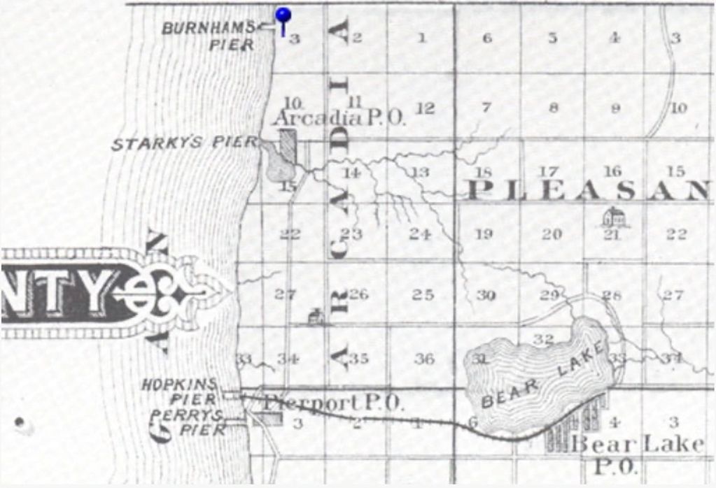
1882 Map of
Northwest Manistee County
Burnham is north of Starky's
Pier in Arcadia. (Arcadia's pier
should be spelled "Starke's Pier"
after Henry Starke.)


1903 Burnham Plat Map
By 1903, many of the buildings
in Burnham had been moved to
Arcadia.

Burnham Pier into Lake Michigan
This is probably a photo of the
Burnham pier, a standard bridge
pier that extended several
hundred feet into Lake Michigan.
Piers like this one could only be
used in fairly calm weather after
the ice was gone in April or May
and before the ice returned in
November or December. The
ship moored at the end of the
pier is similar to the Arcadia, and
there is evidence that the
Arcadi
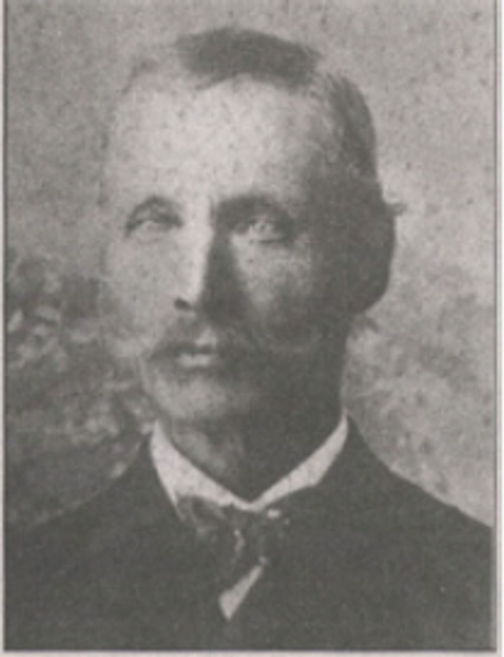
Dean Hull 1903
Dean Alexander Hull was the
foreman of the Burnham Wood
and Piering Company in
Burnham.
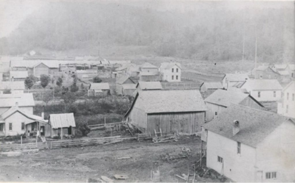
Burnham in the 1890s
Judging by the hills in the
background, this is probably a
northerly view.


1882 Map of Northwest Manistee County
Malcolm is east of "Starky's Pier"
in Arcadia.


The Route of the Narrow Gauge Railway
The Starke Land & Lumber Company Company's railway ran from Arcadia east to Malcolm. The top of the figure shows the route from Arcadia east to Malcolm on the right. The bottom of the figure shows the elevation that corresponds to each location on the route. Note the sudden elevation changes just west of Malcolm that required the use of four trestles. -- Map by

The Route of the Standard Gauge Railway
The dotted line on the left shows the old narrow gauge route to Malcolm. The solid line shows the route of the new standard gauge railway.


Facilities at Malcolm
An ABRR railway siding at
Malcolm picked up produce and
livestock. The Pickle Station
shown in the center of this picture processed local cucumbers. Note the store and post office in the picture's lower
right corner. -- Drawing by John
W. Martin. Used with permission.

Barrels of Pickles
This is a warehouse in Malcolm used to store pickles produced from local cucumbers. The label on the
barrel in the foreground reads "Dill No 8s 8/30/30."


M-22 Looking North at the
County Road
As the tall sign says, Pierport is
one mile to the left. Bear Lake is
four miles to the right.
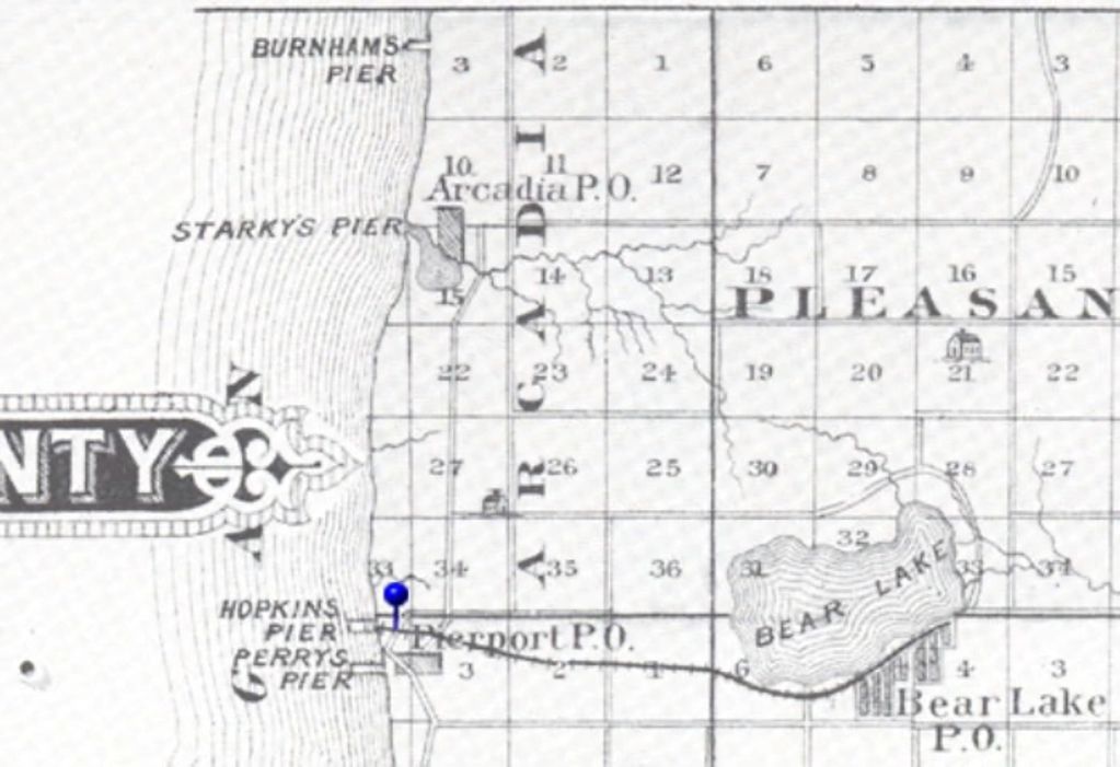
1883 Map of Northwest
Manistee County
Pierport is south of Starkey's
Pier in Arcadia and west of Bear
Lake. The map shows two piers
into Lake Michigan at Pierport:
Hopkins Pier and Perry's Pier.
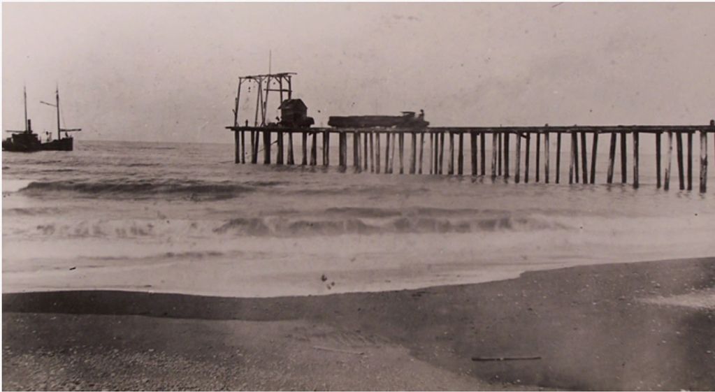
A Pier at Pierport
Note the small locomotive on the pier pulling cars loaded with wood products. The crane at the end of the pier is ready to load waiting ship, and the weather is cooperating. The photo is undated, but
this is probably the Hopkins pier, which was built in 1879.


C. W. Perry

C. W. Perry Ledger Title
This is the title from the cover
page of a ledger used to track
store transactions. For example,
the ledger shows that on May
17, 1881 William Quimby
purchased "B. Wheat & Feed" for
$7.00.


The Bear Lake and Eastern Railway Trestle near Pierport
The trestle flattened out the area so problematic for the tram railway. It was located on the H. C. Matteson farm, which later became the Harmer farm.


1885 Pierport Map
This map shows the buildings along Main Street. The general store was at the southeast corner of Perry and Main Streets Farther up the street to the west was Pratt's Lake House, and the Perry
sawmill and flour mill.

Birdseye View of Pierport
The C. W. Perry general store is the light colored building just left of center in the photo. Date unknown.

The Beach at Pierport
Note the remains of the pier just behind the bathers and a second pier in the background on the right.
These are the remains of Perry's pier and the Hopkins pier respectively.