Railroad Maps:
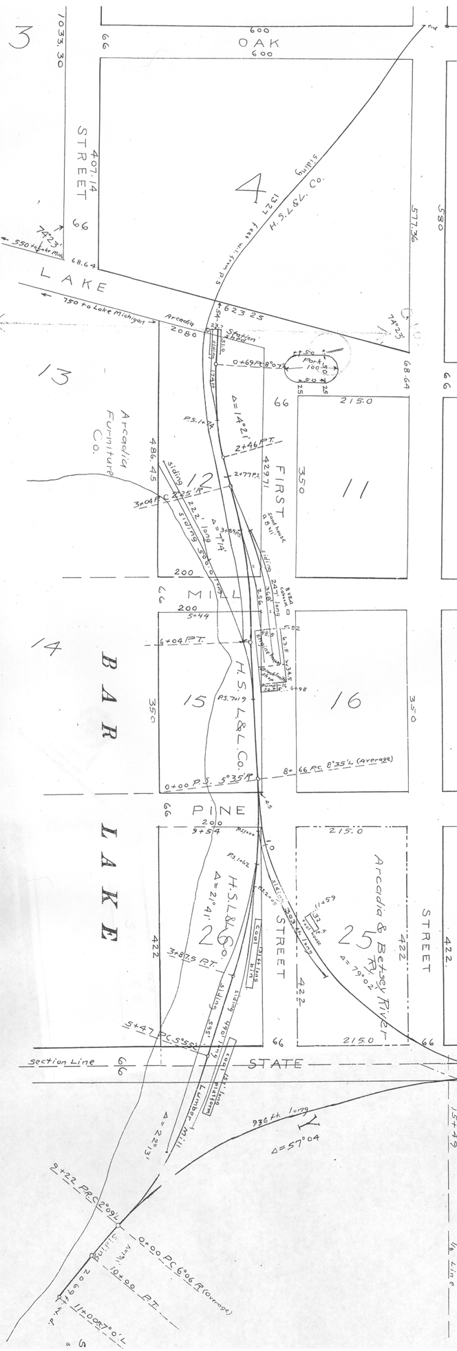
1914 Valuation Map of Northeast Arcadia Lake Shore
Next | Previous | Return to Start
List of Maps
|
 |
 |

This is a detailed map of the portion of the ABRR route along Lake Arcadia's northeast shore. Note the Engine House above section 15 and the coal bin and platform near section 26. The right side of the drawing implies the rail stops before getting to the point, but that is just omitted from this blow-up of the lake shoreline siding and buildings.
-- "Station Map: Arcadia and Betsey River Ry." June 30, 1914. National Archives and Records Administration
Step back for a higher level view.
|
 |
List of Maps
Next | Previous | Return to Start


