Arcadia's Very Early History
Our story begins when glaciers covered the Arcadia area.
|
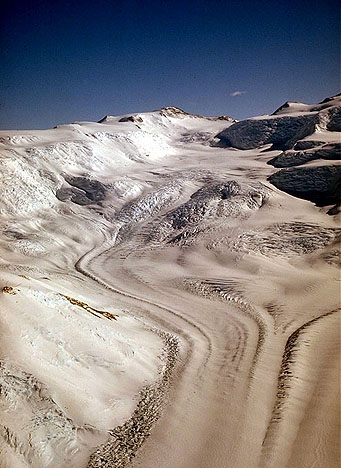
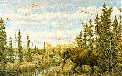
“First there was the ice; two miles high, hundreds of miles wide and many centuries deep. It came down from the darkness of the world, and it hung over the eaves, and our Michigan country lay along the line of the overhang. To be sure, all of the ice was gone. It had melted, they said, ten thousand years ago; but they also pointed out that ten thousand years amounted to no more than a flick of the second hand on the geologic time clock.” Glaciers Scoured Ancient Rock FormationsThe underlying bedrock of the lower peninsula of Michigan is a series of sedimentary rock layers deposited like stacked saucers by ancient seas that covered much of Michigan for millions of years. Several times huge sheets of ice advanced from the north and receded. In the process, they scoured the bedrock; created huge channels for lakes; deposited ridges of sand, gravel, clay, and other material carried along by the glaciers; pushed, crushed, and packed material deposited earlier; and melted to fill icy lakes and streams that eroded the landscape further. Bedrock in the Arcadia area is mostly hidden by relatively loose material and rocks deposited by moving glaciers. The landscape has pronounced hills and valleys bounded by bluffs on the west next to the eastern shore of Lake Michigan, the remnant of the western part of ancient Lake Algonquin. Dunes Formed from Blowing SandRivers and streams carried sand to the beach of Lake Michigan, and as lake levels increased, bluffs eroded adding more sand to the beach. Waves cleaned and sorted the sand to remove silt and clay and to separate fine sand and gravel. As beaches widened and dried, prevailing winds carried the sand up and east to form large coastal dunes. Eventually plants gained a foothold, which stabilized some dunes and encouraged additional plant growth. Because of the combination of course soils, diverse terrain, the moderation of severe temperatures (due to the large, nearby body of water), and the dynamic nature of dunes, small areas of landscape could support a greater number of plants than most comparably sized areas in the state. Vegetation and Animals Invaded the AreaAs glaciers finally receded and the icy lakes warmed, Michigan's landscape evolved from frozen tundra to the mosaic of northern hardwoods and pine forests that eventually drew lumbermen to the area. Early on, re-advancing glaciers wiped out invading vegetation, but the invasion was relentless, so as the glaciers receded, glacial till and blown-in loess were covered by vegetation re-invaded the area. Around 11,800 years ago, Arcadia's landscape consisted of tundra next to glaciers not far to the north. Several miles inland you would have found open, northern style parkland with mammoths and herds of caribou. Eventually these gave way to mastodons, smaller more scattered herds of caribou, giant beaver, elk, and moose. |
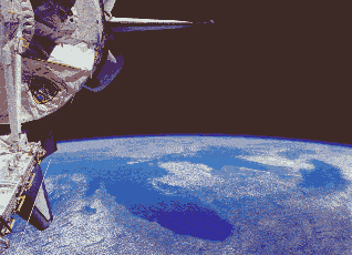 Michigan from Space Looking northeast at the Great Lakes region you can clearly see Lake Michigan in the foreground and the mitten shape of Michigan's lower peninsula. Arcadia is in the northwest corner of the lower peninsula on the eastern shore of Lake Michigan. -- Photo Courtesy of NASA |
|
About 10,000 years ago, Arcadia would have been situated in a spruce pine forest. Subarctic grassland with scattered woodlots was eventually replaced by forest with a closed canopy in some places. About this time the ancestors of all native Americans were probably in the area. These people were modern humans that probably crossed the land bridge from Asia. They followed large game, especially caribou, but they also hunted small game and foraged for edible plants. Early native Americans lived along the shores of lakes and rivers in small groups and moved often. As a result, little obvious was left behind in general to mark their presence and identify places worth closer examination by archeologists. As lake levels rose, what was left behind was destroyed or hidden. Around 5,000 years ago, the Arcadia area landscape was evolving into a northern hardwood forest with pine oak forest land to the immediate south and east. Extensive sand dunes formed along Lake Michigan's eastern shores. White pine was prominent on stabilized dunes. Jack pine may have been found in specialized habitats. The stage was set. The next time the landscape would change significantly would be when European lumbermen and farmers cleared the forest and began extensive tillage. |
|