Arcadia's Early Neighbors
Next | Previous
This map is a portion of an 1873 map of Michigan's Benzie and Manistee counties. The pushpins identify the locations of four settlements near Arcadia.
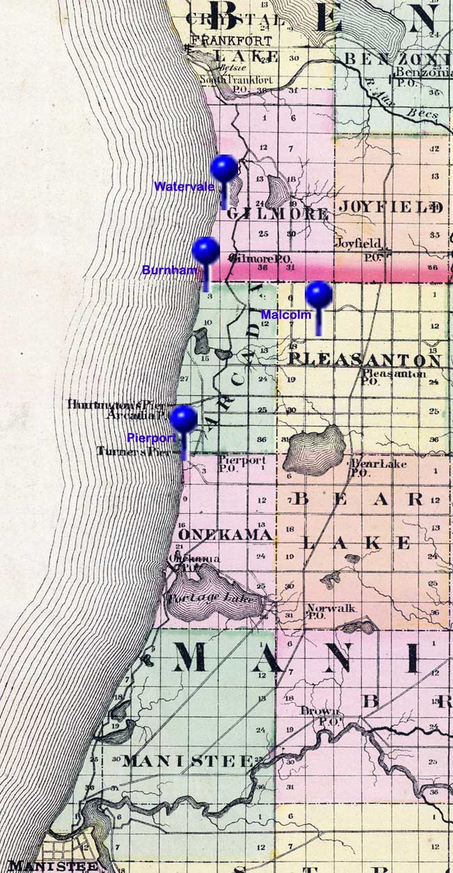 1873 Map 1873 MapThis map shows the Lake Michigan shorline of Michigan's Benzie and Manistee counties from Frankfort in the north to Manistee in the south. The pushpins on the map identify the locations of settlements near early Arcadia. |
Watervaleis about four miles north of Arcadia. In 1890, Leo F. Hale bought the land south of Lower Herring Lake where he started a lumber camp originally called Hale's Pier. He built the original buildings incorporated as Watervale and transformed later from a ghost town into a resort. Burnhamwas Arcadia's closest neighbor to the north. Its story started in 1882, when the Burnham Wood & Piering Company built a pier into Lake Michigan and a sawmill for its lumbering operation. Like many other lumbering towns, Burnham didn't last long after the wood was gone. Many of the buildings in Burnham were moved to Arcadia. Malcolmwas the station at the east end of the Starke Land and Lumber Company's narrow gauge logging railroad. Construction of the railway began in 1881. In 1893, when the railroad was converted to standard gauge, rerouted, and extended to Henry and Copemish, Malcolm continued to be a key stop along the new Arcadia and Betsey River Railway. Malcolm provided pickles, potatoes, livestock, and other locally produced goods. Malcolm had a livestock and produce station, a school, a store, post office, sawmill, homes, and farms. Pierportstarted in 1866 as Turnersport, when the Turnersport Pier Company built a pier there to ship wood products. Renamed Pierport in 1871, it developed into a thriving settlement with general stores, a school, a post office, hotels, a sawmill, a stave factory, two piers, a railway connection to Bear Lake, homes, and farms. |
Next | Previous