The Earliest Sawmills in the Arcadia Area
Next | Previous | Return to Start
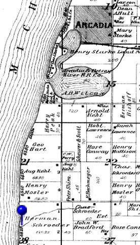
The Water-Powered Sawmill near Lower Herring LakeAccording to Sam Gilbert, the sawmill owned by “Old Averill” was probably the first in the area. When Sam arrived at Watervale in 1854, Harrison Averill was operating a... “...sawmill located on the creek connecting the two Herring Lakes, about forty or fifty rods from its mouth at Lower Herring. … It was a waterpower mill of the single muley type (an up-and-down saw), and had a capacity of 7,000 feet of pine lumber in twelve hours. As there was never a dearth of water, the mill was run day and night, two men being a full force and short shifts made. The big pines were cut on the hills north of Upper Herring Lake, hauled to the water and floated down the creek to the mill. From other directions they must have been hauled in with teams." Each section in the map is a square mile. A rod is 16.5 feet, so as John Howard described it, "forty to fifty rods" from the creek's mouth at Lower Herring Lake is 660 to 825 feet, which is a little over 1/7 mile. This would place the sawmill today about where Herring Creek crosses M-22. “An inclined track made of two-by-four scantlings ran from the mill to the mouth of the creek, and on this was operated a truck of 1,000 feet capacity. Its wheels were wooden, sawed from the end of a log, and banded with metal to make them lasting. The truck ran down the grade of its own momentum after being started. The lumber was rafted across the little lake to the channel, and there was much swimming sport in connection. It was floated down to the outlet and to the schooner lying in anchor in Lake Michigan” |
|
The Steam-Powered Sawmill South of ArcadiaAccording to an account written in 1879 by an unknown author, the first settlers who wandered into this part of the wilderness of northern Michigan were Dr. W.L. Dempster from Chicago, G.W. Boss from Pennsylvania, and Henry Huntington from Indiana along with their families. In 1874, Henry Huntington built the Huntington & Co. steam-powered sawmill on Sprague's creek on the road to Pierport about four miles south of present day Arcadia. According to the 1874 census, the sawmill employed five people and produced 3,000,000 feet of lumber valued at $7,500, which is .025 cents per foot. Until the sawmill was abandoned in 1880, it provided lumber primarily to people in the area, but because of its location near Lake Michigan, it also provided lumber to ships that carried lumber primarily to Chicago.
When people homesteaded, they cut down trees themselves or with the help of their neighbors and used those logs to build their first homes. Sawmills like the Huntington sawmill provided finished lumber used for other purposes, for example, to build better homes, barns, boarding houses, schools, stores, and other structures for settlements built around a thriving lumber industry. |
|
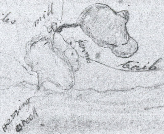 Sam Gilbert's Map of Herring Lakes
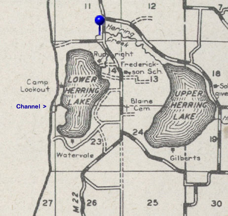 Old Averill's Sawmill